 |
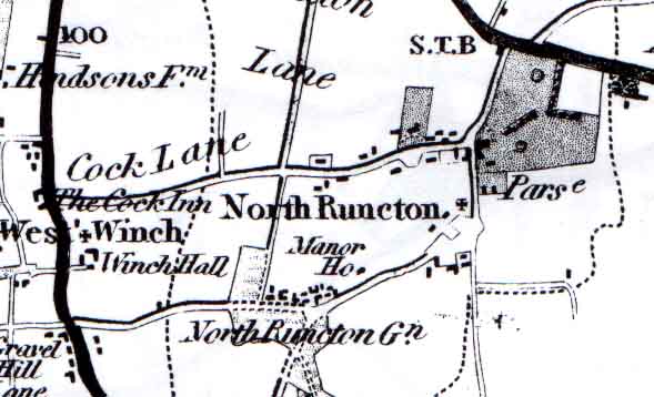
Map of the village in 1826, from Bryant's Map.
Reproduced with permission from the Larks Press edition see book list
This map shows the junction at the main road as a dog-leg, and next to it what appears to be park land north of the Parsonage ("Parse").
There is a string of dwellings along what is now Rectory Lane (or "Cock Lane", with the pub of that name at the West Winch end). The other cluster is around the Common, here called the Green ("Gn") and the Manor House.
The Church is shown by a cross to the right of the words "North Runcton". Notice that the road runs to the east of it, not to the west as at present. It seems that when the Hall was built in 1835, this road was diverted westwards by about 300 metres (a fifth of a mile) and this is when it became known as "New Road".